
River Basins

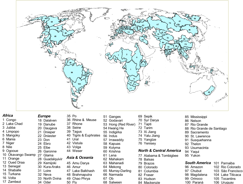
This map shows the location of 106 major watersheds of the world. It includes the world's largest transboundary watersheds and other small basins that are representative of a particular geographic area. Omitted regions, shown in white, are primarily smaller coastal drainage basins or regions with no permanent rivers.
DOWNLOAD PDF of this page(size approx. 2MB)
Visit the Water Resources eAtlas - A river basin data and information system
Analytical Overview
The base data layer used for geographic definition of the watersheds was based on a revised version of the Major Watersheds of the World dataset, distributed on the GlobalARC CD-ROM by the U.S. Army Corps of Engineers Construction Engineering Research Laboratories (CERL). The basins were digitally derived using ETOPO5, 5-minute gridded elevation data, and known locations of rivers. Because of the low resolution of the elevation data used to derive the base data layer, boundaries were coarse and an effort was made to refine the basin boundaries as follows. WRI revised and checked basin boundaries by overlaying ArcWorld 1:3 million rivers. In cases where rivers crossed basin boundaries, the boundary was edited using a 1-kilometer Digital Elevation Model as a guide and redrawing the boundaries along identifiable ridges. After editing the boundaries, all subbasins were identified and labeled for each primary basin.
Sources:
- Environmental Systems Research Institute. 1992, ArcWorld 1:3M. Continental Coverage. Redlands, CA: ESRI.
- US Army Corps of Engineers Construction Engineering Research Laboratories (CERL). Major Watersheds of the World.